Yarovoye, Altai Krai
Yarovoye
Яровое | |
|---|---|
 Lake Bolshoye Yarovoye and the chemical plant in Yarovoye | |
| Coordinates: 52°56′N 78°35′E / 52.933°N 78.583°E | |
| Country | Russia |
| Federal subject | Altai Krai[1] |
| Founded | 1943 |
| Town status since | 1993 |
| Area | |
• Total | 44.38 km2 (17.14 sq mi) |
| Elevation | 95 m (312 ft) |
| Population | |
• Total | 18,604 |
| • Density | 420/km2 (1,100/sq mi) |
| • Subordinated to | town of krai significance of Yarovoye[1] |
| • Capital of | town of krai significance of Yarovoye[1] |
| • Urban okrug | Yarovoye Urban Okrug[3] |
| • Capital of | Yarovoye Urban Okrug[3] |
| Time zone | UTC+7 (MSK+4 |
| Postal code(s)[5] | 658837, 658839 |
| OKTMO ID | 01730000001 |
| Website | yarovoe |
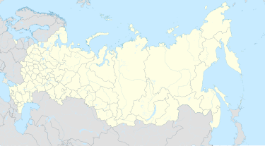
Yarovoye (Russian: Ярово́е) is a town in Altai Krai, Russia, located on the north shore of lake Bolshoye Yarovoye, 402 kilometers (250 mi) west of Barnaul, the administrative center of the krai. Population: 18,604 (2010 Census);[2] 21,363 (2002 Census);[6] 21,784 (1989 Soviet census).[7]
History
[edit]It was established in 1943 and was granted town status in 1993.[citation needed]
Administrative and municipal status
[edit]Within the framework of administrative divisions, it is incorporated as the town of krai significance of Yarovoye—an administrative unit with the status equal to that of the districts.[1] As a municipal division, the town of krai significance of Yarovoye is incorporated as Yarovoye Urban Okrug.[3]
Social status
[edit]Yarovoye is a popular resort that welcomes around 2 million people per summer season (June-August). The city gained popularity in the 1980s, even before "Prichal" came to build the tourist infrastructure. The Salt Lake "Big Yarovoye" is the main benefit of the city. Tourists come to breathe the healthy air, float on top of the water and walk on the healing black dirt that lies underground of the lake.
References
[edit]Notes
[edit]- ^ a b c d e Law #28-ZS
- ^ a b Russian Federal State Statistics Service (2011). Всероссийская перепись населения 2010 года. Том 1 [2010 All-Russian Population Census, vol. 1]. Всероссийская перепись населения 2010 года [2010 All-Russia Population Census] (in Russian). Federal State Statistics Service.
- ^ a b c Law #117-ZS
- ^ "Об исчислении времени". Официальный интернет-портал правовой информации (in Russian). June 3, 2011. Retrieved January 19, 2019.
- ^ Почта России. Информационно-вычислительный центр ОАСУ РПО. (Russian Post). Поиск объектов почтовой связи (Postal Objects Search) (in Russian)
- ^ Federal State Statistics Service (May 21, 2004). Численность населения России, субъектов Российской Федерации в составе федеральных округов, районов, городских поселений, сельских населённых пунктов – районных центров и сельских населённых пунктов с населением 3 тысячи и более человек [Population of Russia, Its Federal Districts, Federal Subjects, Districts, Urban Localities, Rural Localities—Administrative Centers, and Rural Localities with Population of Over 3,000] (XLS). Всероссийская перепись населения 2002 года [All-Russia Population Census of 2002] (in Russian).
- ^ Всесоюзная перепись населения 1989 г. Численность наличного населения союзных и автономных республик, автономных областей и округов, краёв, областей, районов, городских поселений и сёл-райцентров [All Union Population Census of 1989: Present Population of Union and Autonomous Republics, Autonomous Oblasts and Okrugs, Krais, Oblasts, Districts, Urban Settlements, and Villages Serving as District Administrative Centers]. Всесоюзная перепись населения 1989 года [All-Union Population Census of 1989] (in Russian). Институт демографии Национального исследовательского университета: Высшая школа экономики [Institute of Demography at the National Research University: Higher School of Economics]. 1989 – via Demoscope Weekly.
Sources
[edit]- Алтайский краевой Совет народных депутатов. Закон №28-ЗС от 1 марта 2008 г. «Об административно-территориальном устройстве Алтайского края», в ред. Закона №16-ЗС от 4 апреля 2017 г. «О присоединении станции Железнодорожная Казарма 572 км к посёлку Октябрьскому Октябрьского сельсовета Кулундинского района Алтайского края и внесении изменений в отдельные законы Алтайского края». Вступил в силу 8 марта 2008 г. Опубликован: "Алтайская правда", №67, 8 марта 2008 г. (Altai Krai Council of People's Deputies. Law #28-ZS of March 1, 2008 On the Administrative-Territorial Structure of Altai Krai, as amended by the Law #16-ZS of April 4, 2017 On Merging the Station of Zheleznodorozhnaya Kazarma 572 km into the Settlement of Oktyabrsky in Oktyabrsky Selsoviet of Kulundinsky District of Altai Krai and on Amending Various Laws of Altai Krai. Effective as of March 8, 2008.).
- Алтайское краевое Законодательное Собрание. Закон №117-ЗС от 3 декабря 2008 г. «О статусе и границах муниципального и административно-территориального образования город Яровое Алтайского края», в ред. Закона №55-ЗС от 5 июля 2012 г. «О внесении изменений в отдельные Законы Алтайского края в связи с преобразованием муниципальных и административно-территориальных образований». Вступил в силу через 10 дней после дня официального опубликования. Опубликован: "Алтайская правда", №372, 16 декабря 2008 г. (Altai Krai Legislative Assembly. Law #117-ZS of December 3, 2008 On the Status and the Borders of the Municipal and the Administrative-Territorial Formation of the Town of Yarovoye of Altai Krai, as amended by the Law #55-ZS of July 5, 2012 On Amending Various Laws of Altai Krai Due to the Transformation of the Municipal and Administrative-Territorial Formations. Effective as of the day which is 10 days after the day of the official publication.).


