Tlatlauquitepec
Appearance
Tlatlauquitepec (municipality) | |
|---|---|
Municipality and town | |
 | |
| Country | |
| State | Puebla |
| Time zone | UTC-6 (Central Standard Time) |
| • Summer (DST) | UTC-5 (Central Daylight Time) |
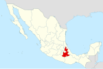
Tlatlauquitepec (municipality) is a town and municipality in the Mexican state of Puebla in south-eastern Mexico.[1]
Tlatlauquitepec is currently designated as a Pueblo Mágico. Its name originates from the Nahuatl words "Tlatlahui" (to color), "Téptl" (hill), and "Co" (place), collectively meaning "hill that colors".[1]
It was officially designated as a Magic Town in 2012.
References
[edit]- ^ "-". Enciclopedia de los Municipios de México. Instituto Nacional para el Federalismo y el Desarrollo Municipal. Retrieved January 4, 2010.
19°51′05″N 97°29′46″W / 19.8514°N 97.4961°W
