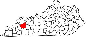
Sixth Vein, Kentucky
Appearance
Sixth Vein, Kentucky | |
|---|---|
| Coordinates: 37°15′5″N 87°40′20″W / 37.25139°N 87.67222°W | |
| Country | United States |
| State | Kentucky |
| County | Hopkins |
| Elevation | 505 ft (154 m) |
| Time zone | UTC-6 (Central (CST)) |
| • Summer (DST) | UTC-5 (CST) |
| GNIS feature ID | 509067[1] |
Sixth Vein is an unincorporated community located in Hopkins County, Kentucky, United States. The site was home to the Sixth Vein mine which operated during the 1930s and 40s. On 18 March 1944 two men were killed at the Sixth Vein Mine in an explosion.[2] A further three men were killed in an explosion at the mine in 1946.[3]
References
[edit]- ^ U.S. Geological Survey Geographic Names Information System: Sixth Vein, Kentucky
- ^ "Proceedings of the Kentucky Mining Institute". Kentucky Mining Institute: 143. 1944. Retrieved November 30, 2020.
- ^ Journal of the House of Representatives of the Commonwealth of Kentucky, Vol 4. Kentucky. General Assembly. House of Representatives. 1946. p. 4121. Retrieved November 30, 2020.


