Cranwich
| Cranwich | |
|---|---|
 St. Mary's Church | |
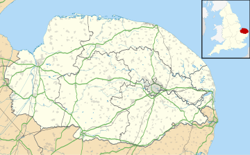
Location within Norfolk | |
| Area | 7.38 km2 (2.85 sq mi) |
| OS grid reference | TL781947 |
| Civil parish |
|
| District | |
| Shire county | |
| Region | |
| Country | England |
| Sovereign state | United Kingdom |
| Post town | THETFORD |
| Postcode district | IP26 |
| Dialling code | 01842 |
| Police | Norfolk |
| Fire | Norfolk |
| Ambulance | East of England |
| UK Parliament | |
Cranwich is a village and civil parish in Norfolk, England.
Cranwich is located 8.6 miles (13.8 km) north-west of Thetford and 29 miles (47 km) west of Norwich.
History
[edit]Cranwich's name is of Anglo-Saxon origin and derives from the Old English for 'a marsh with cranes or herons.'[1]
In the Domesday Book, Cranwich is listed as a settlement of 36 households in the hundred of Grimshoe. In 1086, the village formed part of the estates of William de Warenne.[2]
In 1935, a labour camp was established in Cranwich by the Ministry of Labour for unemployed men. The camp gave manual work in forestry and quarrying and was closed at the onset of the Second World War, where it was used by the British Army.[3]
Geography
[edit]In the 2011 Census, Cranwich's population is measured as a civil parish and therefore in the same survey as Ickburgh. The combined population of Ickburgh and Cranwich in 2011 was recorded as 309 residents living in 161 households.[4]
Cranwich is located close to Watermill Broad and the course of the River Wissey. The A134, between King's Lynn and Colchester, runs through the village.
St. Mary's Church
[edit]Cranwich's parish church is dedicated to Saint Mary and is one of Norfolk's 124 round-tower churches, dating from the 11th century. St. Mary's is located just off Cranwich Road and has been Grade I listed since 1960.[5]
St. Mary's tower is one of the oldest in Norfolk, but the rest of the building is later. The church was restored in a simple fashion in the Victorian era.[6]
In popular culture
[edit]Cranwich is the setting for the 2009 horror-comedy film Lesbian Vampire Killers, with the village renamed Cragwich in the film.
Governance
[edit]Cranwich is part of the electoral ward of Bedingfield for local elections and is part of the district of Breckland.
Cranwich is located in the constituency of South West Norfolk, which has been represented by Terry Jermy of the Labour Party since 2024.
War memorial
[edit]Cranwich's war memorial is located in Mundford and is a stone memorial topped with a metal cross, which also lists the fallen for Mundford, Lynford and West Tofts. The memorial lists the following from the First World War:[7][8]
| Rank | Name | Unit | Date of Death | Burial |
|---|---|---|---|---|
| Pte. | Herbert Nickolls | 1st Bn., Norfolk Regiment | 13 May 1917 | Mont-Huon Military Cemetery |
| Pte. | Reginald T. Boldry | 1/4th Bn., Norfolk Regt. | 17 Aug. 1916 | Cairo War Cemetery |
| Pte. | Henry P. Long | 1/4th Bn., Norfolk Regt. | 19 Apr. 1917 | Jerusalem Memorial |
| Pte. | John V. Crook | 9th Bn., Norfolk Regt. | 30 Sep. 1916 | St. Sever Cemetery |
References
[edit]- ^ "Key to English Place-names". kepn.nottingham.ac.uk. Retrieved 18 December 2024.
- ^ "Cranwich | Domesday Book". opendomesday.org. Retrieved 18 December 2024.
- ^ "MNF25240 - Norfolk Heritage Explorer". www.heritage.norfolk.gov.uk. Retrieved 18 December 2024.
- ^ Office for National Statistics. (2011). Retrieved December 20, 2022. https://www.nomisweb.co.uk/reports/localarea?compare=E04006132
- ^ "CHURCH OF ST MARY, Cranwich - 1305340 | Historic England". historicengland.org.uk. Retrieved 18 December 2024.
- ^ "Cranwich". www.norfolkchurches.co.uk. Retrieved 18 December 2024.
- ^ "Roll of Honour - Norfolk - Mundford". www.roll-of-honour.com. Retrieved 18 December 2024.
- ^ "Geograph:: Caister to Croxton :: War Memorials in Norfolk". www.geograph.org.uk. Retrieved 18 December 2024.
Media related to Cranwich at Wikimedia Commons
