Category:South Oxhey
Jump to navigation
Jump to search
English: South Oxhey is a suburb of Watford in the Watford Rural parish of the Three Rivers district of Hertfordshire, England. It is located in the south western corner of Hertfordshire and close to the boundary with Greater London. In the 2009 Hertfordshire County Council elections, South Oxhey returned a British National Party Councillor.
Italiano: South Oxhey è un villaggio della contea dell' Hertfordshire, in Inghilterra. Si trova nella parrocchia civile di Watford Rural.
village in Hertfordshire, England, UK | |||||
| Upload media | |||||
| Instance of | |||||
|---|---|---|---|---|---|
| Location | Watford Rural, Three Rivers, Hertfordshire, East of England, England | ||||
 | |||||
Subcategories
This category has the following 4 subcategories, out of 4 total.
C
- Carpenders Park Cemetery (11 F)
O
- Oxhey Chapel (4 F)
- Oxhey Woods (7 F)
Media in category "South Oxhey"
The following 26 files are in this category, out of 26 total.
-
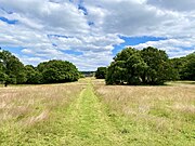
South Oxhey Playing Fields, South Oxhey, Hertfordshire.jpg 4,032 × 3,024; 4.43 MB
-
Bowring Green, South Oxhey - geograph.org.uk - 116484.jpg 640 × 480; 208 KB
-
Carpenders Park stn east entrance.JPG 1,600 × 1,200; 497 KB
-
Carpenders Park, Delta Gain, The Parade - geograph.org.uk - 1282480.jpg 640 × 480; 104 KB
-
Carpenders Park, Greenfield Avenue - geograph.org.uk - 77445.jpg 640 × 480; 92 KB
-
Carpenders Park, Sherwoods Wood - geograph.org.uk - 1272313.jpg 640 × 480; 149 KB
-
Carpenders Park, St. George's Drive - geograph.org.uk - 77443.jpg 640 × 480; 93 KB
-
Carpenders Park, The Partridge - geograph.org.uk - 1272954.jpg 640 × 466; 64 KB
-
Hatch end wcml railway 2051124.jpg 640 × 389; 146 KB
-
London Loop Footpath - geograph.org.uk - 1280887.jpg 427 × 640; 73 KB
-
Merry Hill looking towards Carpenders Park (geograph 3129506).jpg 2,048 × 1,536; 1.5 MB
-
South Oxhey Library - geograph.org.uk - 1384602.jpg 640 × 480; 86 KB
-
South Oxhey, Hallowes Crescent - geograph.org.uk - 67643.jpg 640 × 480; 102 KB
-
South Oxhey, Mundesley Close - geograph.org.uk - 1375131.jpg 640 × 480; 67 KB
-
South Oxhey, Offerton House - geograph.org.uk - 1375071.jpg 640 × 454; 73 KB
-
South Oxhey, Oxhey Drive - geograph.org.uk - 1375295.jpg 640 × 462; 81 KB
-
South Oxhey, Oxhey Drive - geograph.org.uk - 1375375.jpg 640 × 480; 95 KB
-
South Oxhey, Prestwick Road - geograph.org.uk - 67651.jpg 640 × 480; 101 KB
-
South Oxhey, St Andrew's Road shops - geograph.org.uk - 1375008.jpg 640 × 480; 61 KB
-
South Oxhey, The Ox - geograph.org.uk - 1375024.jpg 640 × 480; 86 KB
-
The edge of Oxhey Fields - geograph.org.uk - 108115.jpg 640 × 480; 94 KB


