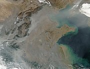
Category:Satellite pictures of China
Jump to navigation
Jump to search
Subcategories
This category has the following 29 subcategories, out of 29 total.
Pages in category "Satellite pictures of China"
This category contains only the following page.
L
Media in category "Satellite pictures of China"
The following 200 files are in this category, out of 561 total.
(previous page) (next page)-
106.71680E 26.58748N.png 1,280 × 706; 1.37 MB
-
113.01085E 28.02336Nczt.jpg 600 × 686; 185 KB
-
121.55000E 29.86667N Ningbo.png 812 × 616; 355 KB
-
China at night by VIIRS.jpg 1,610 × 1,158; 1.52 MB
-
2017 Sichuan landslide.gif 450 × 349; 223 KB
-
2021 Satellite image of Yan'an(延安).png 1,204 × 806; 2.27 MB
-
2021 Satellite image of Yan'an(延安)closer.png 1,219 × 835; 2.29 MB
-
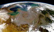
A Pall of Pollution Over Northeastern China (NESDIS 2018-11-02).png 1,920 × 1,080; 3.74 MB
-
Alluvial fan in Tsinghai-annotated.jpg 556 × 537; 238 KB
-
Alluvial fan in Tsinghai.jpg 3,060 × 2,036; 834 KB
-
Anshan 122.98963E 41.11414N.jpg 1,280 × 958; 272 KB
-
Asdust tmo 2008061 lrg.jpg 3,600 × 2,800; 966 KB
-
Asia dust 2000-04-07.jpg 3,319 × 2,750; 2.31 MB
-
Asian Dust, NASA aerospace photography.jpg 2,460 × 2,300; 1.66 MB
-
Baoding 115.48629E 38.85695N.jpg 1,280 × 958; 350 KB
-
Bohai Bay, China ESA213619.jpg 1,620 × 1,620; 663 KB
-
Bohai Bay, China ESA213619.tiff 1,620 × 1,620; 7.54 MB
-
Bohai sea aquaculture planet labs satellite image.jpg 2,659 × 1,995; 1.59 MB
-
Central Asia1.jpg 3,712 × 5,150; 6.79 MB
-
Changchun 125.32286E 43.87998N.jpg 1,280 × 958; 233 KB
-
Changchun Gymnasium.png 502 × 379; 330 KB
-
Changshan Islands and offshore oil platform in fire.jpg 10,980 × 10,980; 65.97 MB
-
Changshan Islands.jpg 1,904 × 3,644; 6.23 MB
-
China 100.78713E 35.63718N.jpg 1,280 × 958; 226 KB
-
China 2017 01 25 (32482168976).jpg 2,640 × 2,704; 1.25 MB
-
China 2017 12 25 (25482358108).jpg 3,200 × 1,664; 1.14 MB
-
China 2017 12 28 (25482356148).jpg 3,200 × 1,664; 977 KB
-
China 25th and 28th December 2017 (38646070334).jpg 1,920 × 1,080; 122 KB
-
China BMNG.jpg 3,328 × 2,881; 6.76 MB
-
China from space.png 1,527 × 970; 1.93 MB
-
China FuQing.jpg 635 × 450; 52 KB
-
China nasa.jpg 1,000 × 574; 97 KB
-
China satellite.png 1,278 × 956; 2.02 MB
-
China Three Kingdoms.jpg 996 × 572; 90 KB
-
China Three Kingdoms.png 1,678 × 964; 2.19 MB
-
China tmo 2008029 lrg.jpg 4,000 × 4,000; 4.56 MB
-
China.A2001313.0330.250m.jpg 4,400 × 5,800; 3.05 MB
-
China.A2002007.0310.250m.jpg 8,000 × 6,000; 5.23 MB
-
China.A2002102.0225.1km.jpg 750 × 1,000; 80 KB
-
China.A2002104.0350.250m.jpg 5,200 × 4,000; 2.42 MB
-
China.A2002249.0255.250m.jpg 4,400 × 3,400; 2.14 MB
-
China.A2004040.0245.250m.jpg 5,600 × 7,200; 5.4 MB
-
China.A2004050.0500.250m.jpg 4,000 × 5,200; 1.6 MB
-
China.A2004056.0245.250m.jpg 4,400 × 3,400; 1.16 MB
-
China.TMO2002163 lrg.jpg 2,600 × 2,000; 967 KB
-
ChinaABomb 2.jpg 600 × 400; 66 KB
-
ChinaDustOverEastAsia.jpg 2,100 × 2,100; 877 KB
-
Chinese Solar Farm, Golmud, China by Planet Labs.jpg 3,646 × 2,734; 1.54 MB
-
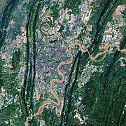
Chongqing, China ESA23338300.jpeg 2,126 × 2,126; 1.56 MB
-
Chongqing, China ESA23338300.tiff 5,314 × 5,314; 80.83 MB
-
Coal Mines, Shanxi Province China - Planet Labs Satellite image.jpg 1,200 × 900; 421 KB
-
Datong 113.28918E 40.08527N.jpg 1,280 × 958; 245 KB
-
Dazhou ali 2011267 geo.tif 2,813 × 4,220; 19.37 MB
-
Dazhou ali 2011267 lrg.jpg 2,813 × 4,220; 3.2 MB
-
Desertification Control Project, Ningxia China - Planet Labs satellite image.jpg 3,510 × 2,633; 2.26 MB
-
Dongguan Arena.png 398 × 373; 236 KB
-
Dongting Lake NASA.jpg 884 × 730; 134 KB
-
Drought causes Yangtze to shrink ESA24418369.jpeg 1,920 × 1,080; 2.83 MB
-
Dust in Northwestern China 2010-04-25.jpg 720 × 480; 77 KB
-
Dust over China 2010-03-12 lrg.jpg 7,400 × 5,600; 4.22 MB
-
Dust over China 2010-03-12.jpg 720 × 480; 235 KB
-
Dust storm in Taklimakan Desert, western China - November 17, 2013.jpg 5,800 × 4,400; 4.98 MB
-
Dust storm in the Gobi Desert, China (8568589729).jpg 7,800 × 6,000; 5.57 MB
-
Duststorm over Beijing ESA23214619.jpeg 1,920 × 2,560; 3.62 MB
-
East China Sea 2017 02 25 (33105952485).jpg 4,806 × 1,534; 1.16 MB
-
EChinaspace.jpg 2,143 × 1,269; 632 KB
-
EHDC2 (iss069e000174).jpg 4,928 × 2,768; 6.21 MB
-
Envisat optical view of China haze ESA201082.tiff 1,062 × 1,501, 2 pages; 4.61 MB
-
Envisat shows Poyang Lake (Poyang Hu) in China ESA203949.jpg 1,024 × 1,024; 301 KB
-
Envisat shows Poyang Lake (Poyang Hu) in China ESA203949.tiff 1,097 × 1,097; 3.47 MB
-
Envisat vs. Sentinel-1 radar ESA312147.tiff 2,296 × 1,436; 9.46 MB
-
Envisat vs. Sentinel-1 radar.jpg 2,296 × 1,436; 1.13 MB
-
Envisat's ASAR sees Tianjin, China's third largest city ESA216958.jpg 1,023 × 1,001; 353 KB
-
ESC large ISS006 ISS006-E-43366.JPG 2,122 × 1,405; 1.45 MB
-
ESTCube-1 orbiting our colourful planet.jpg 3,000 × 1,688; 3.38 MB
-
Evaporate Mine, Inner Mongolia China - Planet Labs satellite image.jpg 1,200 × 900; 425 KB
-
Fuxin 121.67134E 41.99069N.jpg 1,280 × 958; 273 KB
-
Geography of Macau.png 992 × 605; 828 KB
-
Giant Brown Cloud Storm over Asia (NASA).jpg 640 × 480; 120 KB
-
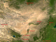
Gobi 106.49229E 41.93582N annotated.png 1,280 × 958; 2.45 MB
-
Gobi 106.49229E 41.93582N.png 1,280 × 958; 2.1 MB
-
Great Wall of China, Satellite image red composite.jpg 1,638 × 739; 1.44 MB
-
Great Wall of China, Satellite image.jpeg 800 × 800; 224 KB
-
Gulf of Tonkin (cropped).jpg 3,629 × 2,041; 2.28 MB
-
Gulf of Tonkin.jpg 5,912 × 3,163; 2.53 MB
-
Gwc-from-space.jpg 500 × 1,501; 338 KB
-
Hainan NASA Terra MODIS 2020-11-13.jpg 1,553 × 1,349; 1.24 MB
-
Hainan satellite.JPG 992 × 735; 129 KB
-
Hainan tmo 07feb05 250m.jpg 1,692 × 1,332; 2.02 MB
-
Han River, Hubei Province China - Planet Labs satellite image.jpg 1,200 × 900; 305 KB
-
Harbin, China, and vicinities, near natural colors, LandSat-5, 2010-09-22.jpg 2,519 × 2,039; 1.75 MB
-
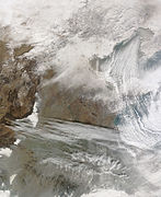
Heavy Snow in Eastern China.jpg 4,400 × 5,400; 5.47 MB
-
Hefei 117.27992E 31.86362N.jpg 1,280 × 958; 272 KB
-
Hengduan tmo 2000360 lrg.jpg 3,556 × 4,448; 4.4 MB
-
Himalaya 85.30820E 32.11063N.jpg 1,280 × 958; 293 KB
-
Himalaya composite.jpg 1,947 × 981; 659 KB
-
Himalayan Glacier, Southern China 2009-12-25. lrg.jpg 3,000 × 3,000; 4.41 MB
-
Himalayan Glacier, Southern China 2009-12-25.jpg 720 × 720; 355 KB
-
Hindu Kush and Karakoram peaks annotated (NASA satellite Terra MODIS).png 1,181 × 606; 1.42 MB
-
Hongshan Arena.png 521 × 385; 377 KB
-
Huang He Delta, China, landuse 1979 to 2010.png 784 × 560; 1.27 MB
-
Hymalayas 86.15103E 31.99726N.jpg 1,280 × 958; 288 KB
-
Industrial Infrastructure, China by Planet Labs.jpg 3,034 × 2,276; 2.23 MB
-
ISS064-E-36826 - View of Earth.jpg 3,712 × 5,568; 1.94 MB
-
Kazak-Chinese border near Tacheng.jpg 720 × 480; 242 KB
-
Laizhou Bay, China ESA23271000.jpeg 19,600 × 14,192; 10.91 MB
-
Laizhou Bay, China ESA23271000.tiff 15,000 × 10,861; 342.95 MB
-
Lanzhou 103.79190E 36.05642N.jpg 1,280 × 958; 239 KB
-
Lanzhou gaseous diffusion plant.png 6,061 × 4,644; 3.44 MB
-
Leizhou Peninsula.jpeg 3,523 × 4,192; 4.88 MB
-
Leizhou peninsula.jpg 1,397 × 1,332; 517 KB
-
Macau, China.jpg 2,048 × 1,365; 2.32 MB
-
Mar Amarillo - BM WMS 2004.jpg 1,060 × 989; 237 KB
-
Mar de China Meridional - BM WMS 2004.jpg 1,060 × 989; 251 KB
-
Mar de China Oriental - BM WMS 2004.jpg 1,060 × 989; 256 KB
-
MarAmarilloGuarani.jpg 1,060 × 989; 136 KB
-
Nansi Lake NASA.jpg 1,032 × 744; 207 KB
-
NASA-Himalaya-Tibet.jpg 686 × 524; 432 KB
-
Ningbo 121.32048E 29.71565N.png 578 × 732; 1.14 MB
-
North and South Korea at night.jpg 4,256 × 2,832; 4.22 MB
-
Northern China - Envisat.jpg 1,920 × 1,269; 1.5 MB
-
Offshore oil platform in fire near Changshan Islands (cropped).jpg 816 × 574; 457 KB
-
Offshore oil platform in fire near Changshan Islands.jpg 2,715 × 1,671; 3.24 MB
-
Paektu-san.jpg 3,032 × 2,004; 5.21 MB
-
Panda Solar Power Plant Datong 2017 09 08 (37246736875).jpg 1,986 × 1,393; 322 KB
-
Panda Solar Station SkySat.jpg 2,853 × 1,957; 952 KB
-
Pollution over east China.jpg 6,000 × 4,600; 2.12 MB
-
Poyang Lake ESA364932.jpg 2,000 × 2,007; 5.99 MB
-
Poyang Lake ESA364932.tiff 6,956 × 6,979; 138.92 MB
-
Qingdao, China ESA349719.jpg 2,000 × 1,542; 4.39 MB
-
Qingdao, China ESA349719.tiff 5,840 × 4,504; 75.28 MB
-
Rainbowmtnspt1 oli 2020261 lrg.jpeg 977 × 814; 1.04 MB
-
Rainbowmtnspt2 oli 2020261 lrg.jpeg 1,406 × 937; 1.64 MB
-
RE mine in Baiyun Ebo, Inner Mongolia.jpg 1,306 × 1,066; 295 KB
-
Rongbuk Glacier animation.gif 990 × 610; 1.68 MB
-
SandSpillsInYellowSea.jpg 750 × 854; 71 KB
-
Satellite image of Conson Gymnasium.png 430 × 380; 232 KB
-
Satellitenbild Nordchina und Mongolei-2.jpg 2,553 × 1,783; 4.7 MB
-
Satellitenbild Nordchina und Mongolei.jpg 2,553 × 1,783; 2.1 MB
-
Severe Tropical Storm Chanthu at peak strength (07-21-10).jpg 5,600 × 7,200; 4.37 MB
-
Shandong Arena.png 510 × 434; 313 KB
-
Shenyang 123.38236E 41.77365N.jpg 1,280 × 958; 278 KB
-
Shenyang from International Space Station.jpg 3,032 × 2,008; 1.7 MB
-
Shenzhen 114.09549E 22.54895N.jpg 1,280 × 958; 249 KB
-
Shenzhen Dayun Arena.png 374 × 421; 235 KB
-
Sichuan clouds.jpg 3,200 × 4,200; 2.89 MB
-
Sichuan Haze.jpg 4,400 × 3,400; 3.97 MB
-
SonghuaRiver ASTER 20020401.jpg 2,124 × 2,733; 1.82 MB
-
SpaceX Dragon 16 (cropped).jpg 1,866 × 1,253; 692 KB
-
SpaceX Dragon 16.jpg 5,568 × 3,712; 3.31 MB
-
Spring Sandstorm Scours China 2010-03-20.jpg 720 × 480; 162 KB
-
STS001-009-0096 - View of China (Raw scan).tif 4,400 × 4,600; 57.91 MB
-
STS001-009-0097 - View of China (Raw scan).tif 4,400 × 4,600; 57.91 MB
-
STS001-009-0098 - View of China (Raw scan).tif 4,400 × 4,600; 57.91 MB
-
STS001-009-0099 - View of China (Raw scan).tif 4,400 × 4,600; 57.91 MB
-
STS001-009-0100 - View of China (Raw scan).tif 4,400 × 4,600; 57.91 MB
-
STS001-009-0101 - View of China (Raw scan).tif 4,400 × 4,600; 57.91 MB
-
STS001-009-0102 - View of China (Raw scan).tif 4,400 × 4,600; 57.91 MB
-
STS001-009-0103 - View of China (Raw scan).tif 4,400 × 4,600; 57.91 MB
-
STS001-009-0104 - View of China (Raw scan).tif 4,400 × 4,600; 57.91 MB
-
STS001-009-0105 - View of China (Raw scan).tif 4,400 × 4,600; 57.91 MB
-
STS001-009-0106 - View of China (Raw scan).tif 4,400 × 4,600; 57.91 MB
-
STS001-009-0107 - View of China (Raw scan).tif 4,400 × 4,600; 57.91 MB
-
STS001-009-0108 - View of China (Raw scan).tif 4,400 × 4,600; 57.91 MB
-
STS001-009-0109 - View of China (Raw scan).tif 4,400 × 4,600; 57.91 MB
-
STS001-012-0353 - View of China (Raw scan).tif 4,400 × 4,600; 57.91 MB
-
STS001-012-0355 - View of China (Raw scan).tif 4,400 × 4,600; 57.91 MB
-
STS001-012-0357 - View of China (Raw scan).tif 4,400 × 4,600; 57.91 MB
-
STS001-012-0358 - View of China (Raw scan).tif 4,400 × 4,600; 57.91 MB
-
STS001-012-0359 - View of China (Raw scan).tif 4,400 × 4,600; 57.91 MB
-
STS001-012-0360 - View of China (Raw scan).tif 4,400 × 4,600; 57.91 MB
-
STS001-012-0361 - View of China (Raw scan).tif 4,400 × 4,600; 57.91 MB
-
STS001-012-0362 - View of China (Raw scan).tif 4,400 × 4,600; 57.91 MB
-
STS001-012-0363 - View of China (Raw scan).tif 4,400 × 4,600; 57.91 MB
-
STS001-012-0363 - View of China (Retouched).tif 4,144 × 4,136; 35.2 MB
-
STS001-012-0364 - View of China (Raw scan).tif 4,400 × 4,600; 57.91 MB
-
STS001-012-0365 - View of China (Raw scan).tif 4,400 × 4,600; 57.91 MB
-
STS001-012-0366 - View of China (Raw scan).tif 4,400 × 4,600; 57.91 MB
-
STS001-012-0367 - View of China (Raw scan).tif 4,400 × 4,600; 57.91 MB
-
STS002-10-588 - View of China (Raw scan).tif 4,393 × 4,600; 57.82 MB
-
STS002-10-588 - View of China.jpg 4,393 × 4,600; 1.38 MB
-
STS002-10-589 - View of China (Raw scan).tif 4,393 × 4,600; 57.82 MB
-
STS002-10-589 - View of China.jpg 4,393 × 4,600; 1.38 MB
-
STS002-10-590 - View of China (Raw scan).tif 4,393 × 4,600; 57.82 MB
-
STS002-10-590 - View of China.jpg 4,393 × 4,600; 1.15 MB
-
STS002-10-591 - View of China (Raw scan).tif 4,393 × 4,600; 57.82 MB
-
STS002-10-591 - View of China.jpg 4,393 × 4,600; 1.23 MB
-
STS002-10-592 - View of China (Raw scan).tif 4,393 × 4,600; 57.82 MB
-
STS002-10-592 - View of China.jpg 4,393 × 4,600; 1.29 MB
-
STS002-10-593 - View of China (Raw scan).tif 4,393 × 4,600; 57.82 MB
-
STS002-10-593 - View of China.jpg 4,393 × 4,600; 1.32 MB
-
STS002-10-594 - View of China (Raw scan).tif 4,393 × 4,600; 57.82 MB
-
STS002-10-594 - View of China.jpg 4,393 × 4,600; 1.2 MB
-
STS002-10-595 - View of China (Raw scan).tif 4,393 × 4,600; 57.82 MB
-
STS002-10-595 - View of China.jpg 4,393 × 4,600; 1.14 MB
-
STS002-10-596 - View of China (Raw scan).tif 4,393 × 4,600; 57.82 MB
-
STS002-10-596 - View of China.jpg 4,393 × 4,600; 1,016 KB


