Category:Old maps of Kazakhstan
Jump to navigation
Jump to search
Use the appropriate category for maps showing all or a large part of Kazakhstan. See subcategories for smaller areas:
| If the map shows | Category to use |
|---|---|
| Kazakhstan on a recently created map | Category:Maps of Kazakhstan or its subcategories |
| Kazakhstan on a map created more than 70 years ago | Category:Old maps of Kazakhstan or its subcategories |
| the history of Kazakhstan on a recently created map | Category:Maps of the history of Kazakhstan or its subcategories |
| the history of Kazakhstan on a map created more than 70 years ago | Category:Old maps of the history of Kazakhstan or its subcategories |
Subcategories
This category has the following 3 subcategories, out of 3 total.
O
- Old maps of Almaty (3 F)
P
- Ptolemy's 7th Asian Map (41 F)
Media in category "Old maps of Kazakhstan"
The following 50 files are in this category, out of 50 total.
-
1730 Van Verden Map of the Caspian Sea - Geographicus - CaspienSea-vanverden-1721.jpg 2,310 × 3,500; 2.23 MB
-
CEM-44-La-Chine-la-Tartarie-Chinoise-et-le-Thibet-1734-West-2569.jpg 1,920 × 2,560; 2.08 MB
-
Map of Kazakh Steppe 1792 (small atlas).jpg 2,643 × 2,211; 847 KB
-
Map of Kazakh Steppe 1796 (small atlas).jpg 2,882 × 2,421; 812 KB
-
Подробная карта Российской империи и близлежащих заграничных владений — лист 089.jpg 4,872 × 4,488; 9.98 MB
-
Preliminary Map of Eastern Turkistan (Bottom Part).jpg 4,466 × 2,879; 3 MB
-
Preliminary Map of Eastern Turkistan (Top Part).jpg 4,548 × 3,448; 2.96 MB
-
Preliminary Map of Eastern Turkistan.png 4,356 × 5,319; 11.22 MB
-
TE&II Vol 06 Fig 083.jpg 1,038 × 1,649; 221 KB
-
TE&II Vol 06 Fig 083b.jpg 972 × 1,392; 197 KB
-
TE&II Vol 06 Fig 098.jpg 1,377 × 1,361; 148 KB
-
TE&II Vol 06 Fig 098b.jpg 1,310 × 1,150; 130 KB
-
Asie, nord. (vers 1900) Asie russe et Tartarie chinoise - btv1b84596699.jpg 9,300 × 7,474; 9.39 MB
-
Chechen Island on a map of 1730.png 495 × 658; 797 KB
-
China-Russia border - protocol of Chuguchak 1864.jpg 935 × 900; 674 KB
-
China-Russia Frontier 1890 - Akmolinskaya.jpg 6,181 × 14,199; 13.68 MB
-
EB9 Map of East and West Turkestan.png 3,851 × 3,026; 1.94 MB
-
Ethnic groups in Kazakhstan. LOC 2005626522.jpg 2,448 × 2,909; 494 KB
-
Ethnic groups in Kazakhstan. LOC 2005626522.tif 2,448 × 2,909; 20.37 MB
-
Frederick de Wit. Maps of Asia. copper engraving. 1670s.gif 2,436 × 1,896; 4.36 MB
-
General Map of Central Asia - Plate 3 (1874).jpg 7,098 × 5,128; 7.36 MB
-
Greatbukharane.jpg 800 × 600; 117 KB
-
Greatbukharanw.jpg 800 × 600; 120 KB
-
Ilin 186x Karta Syr Darinskoj oblast 72.jpg 1,820 × 1,411; 265 KB
-
Kalmykowsk1903.jpg 512 × 593; 250 KB
-
Kasaccia Horda.jpg 1,568 × 977; 498 KB
-
Kazakhstan. LOC 2002620301.jpg 2,524 × 3,036; 772 KB
-
Kazakhstan. LOC 2002620301.tif 2,524 × 3,036; 21.92 MB
-
Kazakhstan. LOC 2002620302.jpg 2,543 × 3,296; 834 KB
-
Kazakhstan. LOC 2002620302.tif 2,543 × 3,296; 23.98 MB
-
Kzil-Ord oblasty BSE T20 M1953.jpg 2,789 × 2,130; 4.65 MB
-
National delimitation in Middle Asia.jpg 1,451 × 975; 568 KB
-
Txu-oclc-6654394-nl-44-2nd-ed.jpg 4,350 × 5,564; 6.05 MB
-
USSR map NK 44-2 I-Ning.jpg 5,000 × 3,835; 4.4 MB
-
USSR map NL 44-10 'Tekeli.jpg 5,000 × 3,809; 4.92 MB
-
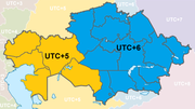
UTC KAZ.png 794 × 445; 81 KB
-
Zakaukazie-Turkestan1903-Semirechye.jpg 1,600 × 1,200; 495 KB
-
Zakaukazie-Turkestan1903.jpg 3,504 × 2,550; 2.02 MB
-
Аблайн-кит (1750).jpg 1,400 × 933; 406 KB
-
Автономная Киргизская Социалистическая Советская Республика.jpg 800 × 620; 386 KB
-
Карта Внутренней Киргизской Орды 1842.jpg 5,004 × 6,166; 10.49 MB
-
Карта Киргизского края.jpg 4,884 × 2,401; 2.94 MB
-
Схема заповедника Ерментау.jpg 2,462 × 3,504; 2.07 MB


