Teddington
largely suburban town centred in the London Borough of Richmond upon Thames
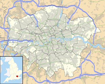
Teddington is a suburban area in the London Borough of Richmond upon Thames. It is in south west London, on the north bank of the River Thames, between Hampton Wick and Twickenham. It stretches inland from the River Thames to Bushy Park.
| Teddington | |
|---|---|
 Teddington Lock Bridge (west) | |
| Location within Greater London | |
| Area | 4.27 km2 (1.65 sq mi) |
| Population | 10,330 (2011)[1] |
| • Density | 2,419/km2 (6,270/sq mi) |
| OS grid reference | TQ159708 |
| London borough | |
| Ceremonial county | Greater London |
| Region | |
| Country | England |
| Sovereign state | United Kingdom |
| Post town | TEDDINGTON |
| Postcode district | TW11 |
| Dialling code | 020 |
| Police | Metropolitan |
| Fire | London |
| Ambulance | London |
| UK Parliament | |
| London Assembly | |
Formerly, it was in the county of Middlesex, which was in its postal county until they were abolished in 1996.
Transport
changeRoad
changeThe A309, A310, A313 and B358 roads pass through Teddington.
Rail
changeTeddington has a railway station.[2]
Bus
changeThe 33, 281, 285, 481, R68, X26 and N33 bus routes pass through Teddington.[3]
References
change- ↑ Key Statistics; Quick Statistics: Population Density Archived 2003-02-11 at the Wayback Machine United Kingdom Census 2011 Office for National Statistics Retrieved 20 December 2013
- ↑ "Teddington Train Station | South Western Railway". www.southwesternrailway.com. Retrieved 2021-01-03.
- ↑ Matters, Transport for London | Every Journey. "Broad Street / Teddington". Transport for London. Archived from the original on 2022-06-30. Retrieved 2021-01-03.
