Webster, Kentucky
Appearance
Webster, Kentucky | |
|---|---|
| Coordinates: 37°53′20″N 86°20′20″W / 37.88889°N 86.33889°W | |
| Country | United States |
| State | Kentucky |
| County | Breckinridge, Meade |
| Elevation | 584 ft (178 m) |
| Population (2010) | |
• Total | 931 |
| Time zone | UTC-6 (Central (CST)) |
| • Summer (DST) | UTC-5 (CDT) |
| ZIP code | 40176 |
| Area code | 270 |
| GNIS feature ID | 506341[1] |
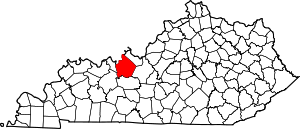
Webster is an unincorporated community in Breckinridge County, Kentucky, United States, located at the junction of Kentucky Route 261, Kentucky Route 333, Kentucky Route 477, and Kentucky Route 2780, 3.1 miles (5.0 km) west of Irvington.[2] Webster has a post office with ZIP code 40176, which opened on August 31, 1852.[3][4] However, the Webster post office has closed permanently, with the mail being routed through Irvington, Kentucky.[5]
References
[edit]- ^ "Webster". Geographic Names Information System. United States Geological Survey, United States Department of the Interior.
- ^ State Primary Road System: Breckinridge County (PDF) (Map). Kentucky Transportation Cabinet. 2012. Retrieved January 6, 2013.
- ^ US Postal Service (2012). "USPS - Look Up a ZIP Code". Retrieved February 15, 2012.
- ^ "Postmaster Finder - Post Offices by ZIP Code". US Postal Service. Retrieved January 6, 2013.
- ^ "WEBSTER POST OFFICE". Retrieved September 7, 2021.


