Category:Derivatives of UN maps
Jump to navigation
Jump to search
Media in category "Derivatives of UN maps"
The following 200 files are in this category, out of 871 total.
(previous page) (next page)-
06-Sector Map Gov IFES Pyithu Hluttaw Election Results 2015 MIMU1351v01 05Feb2016 A3.pdf 1,754 × 2,479; 3.77 MB
-
08-Sector Map Gov IFES Amyotha Hluttaw Election Results 2015 MIMU1351v01 05Feb2016 A3.pdf 1,754 × 2,479; 3.51 MB
-
13-Sector Map Gov IFES-Pyithu Hluttaw-Candidates per Const MIMU1363v01 11Jan2016 A3 0.pdf 1,754 × 2,479; 6.17 MB
-
14-Sector Map Gov IFES Amyotha-Candidates per Const MIMU1363v01 11Jan2016 A3 0.pdf 1,754 × 2,479; 6.18 MB
-
15-Sector Map Gov IFES Pyithu Hluttaw-Turnout MIMU1363v01 11Jan2016 A3 0.pdf 1,754 × 2,479; 6.19 MB
-
16-Sector Map Gov IFES Pyithu Hluttaw-Invalid Votes MIMU1363v01 11Jan2016 A3 0.pdf 1,754 × 2,479; 6.15 MB
-
17-Sector Map Gov IFES Pyithu Hluttaw-Advance Votes MIMU1363v01 11Jan2016 A3 0.pdf 1,754 × 2,479; 6.2 MB
-
18-Sector Map Gov IFES Pyithu Hluttaw-Transferred Votes MIMU1363v01 11Jan2016 A3 0.pdf 1,754 × 2,479; 7.96 MB
-
19-Sector Map Gov IFES No election areas in 2010 12 MIMU1268v01 20Mar2015 A3.pdf 1,754 × 2,479; 2.72 MB
-
1949 Israeli-Syrian General Armistice Agreement (png).png 4,227 × 11,591; 1.82 MB
-
1949 Israeli-Syrian General Armistice Agreement.tiff 6,176 × 11,666; 1.28 MB
-
20-Sector Map Gov IFES Election Cancellations 2010-15Revised MIMU1343v02 02Nov2015 A3.pdf 1,754 × 2,479; 2.92 MB
-
2018 OCHA OpT map Bethlehem.jpg 2,500 × 1,768; 807 KB
-
2018 OCHA OpT map East Jerusalem.jpg 1,768 × 2,500; 920 KB
-
2018 OCHA OpT map Hebron.jpg 2,500 × 1,768; 757 KB
-
2018 OCHA OpT map Jenin.jpg 2,500 × 1,768; 694 KB
-
2018 OCHA OpT map Jericho.jpg 1,768 × 2,500; 590 KB
-
2018 OCHA OpT map Jerusalem.jpg 2,500 × 1,768; 753 KB
-
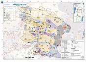
2018 OCHA OpT map Nablus.jpg 2,500 × 1,768; 729 KB
-
2018 OCHA OpT map Qalqilya.jpg 2,500 × 1,768; 634 KB
-
2018 OCHA OpT map Ramallah.jpg 2,500 × 1,768; 819 KB
-
2018 OCHA OpT map Salfit.jpg 2,500 × 1,768; 665 KB
-
2018 OCHA OpT map Tubas.jpg 2,500 × 1,768; 566 KB
-
2018 OCHA OpT map Tulkarm.jpg 1,768 × 2,500; 639 KB
-
2018 OCHA OpT map Tulkarm.svg 1,123 × 1,587; 7.6 MB
-
2018 OCHA OpT map West Bank (cropped).jpg 1,117 × 2,287; 539 KB
-
2018 OCHA OpT map West Bank.jpg 1,768 × 2,500; 780 KB
-
21-Sector Map Gov IFES Sequence of 2015 Election Cancellations MIMU1268v02 04Nov2015 A3.pdf 1,754 × 2,479; 2.78 MB
-
22-Sector Map Gov IFES 2015 Election Cancellations Vacant Seats MIMU1268v02 04Nov2015 A3.pdf 1,754 × 2,479; 1,005 KB
-
22. UNFICYP. Dispositivo Set 64.png 960 × 720; 284 KB
-
23-Sector Map Gov IFES St-Rg Hluttaw Election Results 2015 MIMU1351v01 05Feb2016 A3.pdf 1,754 × 2,479; 2.05 MB
-
25-Sector Map Gov IFES Political Parties Represention in Ady-Reg MIMU1331v01 3Dec15 A3.pdf 1,754 × 2,479; 1.11 MB
-
27-Sector Map Gov IFES Political Parties Represention in Bago-Reg MIMU1331v01 3Dec15 A3.pdf 1,754 × 2,479; 1.25 MB
-
28-Sector Map Gov IFES St-Rg Constituency Bd Parties in Bago-Reg MIMU1327v04 3Dec15 A3.pdf 1,754 × 2,479; 1.24 MB
-
Abkhazia detail map (ka).png 600 × 450; 77 KB
-
Abkhazia detail map in portuguese.PNG 600 × 450; 38 KB
-
Abkhazia detail map.png 600 × 450; 30 KB
-
Abkhazia detail map2 Spanish.png 600 × 450; 96 KB
-
Abkhazia detail map2.png 600 × 450; 87 KB
-
Abkhazia detail map3.jpg 600 × 450; 83 KB
-
Abkhazia detail map3.png 600 × 450; 274 KB
-
Abkhazia detail map4.jpg 600 × 450; 82 KB
-
Abkhazia Kodori Valley.PNG 1,485 × 1,114; 343 KB
-
Acrisol.png 500 × 351; 29 KB
-
Adams bridge map hindi.png 519 × 239; 18 KB
-
Adams bridge map.png 519 × 239; 25 KB
-
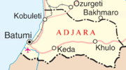
Adjara map.png 634 × 354; 45 KB
-
Afghanistan and Pakistan map (UN).png 1,511 × 1,463; 458 KB
-
AgadezMNJattacks0807.png 363 × 300; 105 KB
-
Agiaria map.png 634 × 354; 43 KB
-
Ahmici.JPG 509 × 390; 56 KB
-
AIDS-Namibie.JPG 2,108 × 2,038; 247 KB
-
Aileu detail map.png 182 × 154; 10 KB
-
Ainaro detail map.png 248 × 296; 13 KB
-
Ajara map he.png 634 × 354; 34 KB
-
Ajara map.png 634 × 354; 18 KB
-
Ajara map–ka.png 634 × 354; 16 KB
-
Al alamayn map-ar.png 714 × 369; 109 KB
-
Al alamayn map.png 714 × 369; 48 KB
-
Al Aqaba map and info (OCHA May 2008).pdf 1,275 × 1,650, 2 pages; 1.29 MB
-
Albeluvisol.png 500 × 351; 28 KB
-
Aliakmon locator map.png 328 × 500; 51 KB
-
Alisol.png 500 × 350; 31 KB
-
Andosol.png 500 × 351; 28 KB
-
Annobón Bioko-es.png 1,895 × 1,098; 495 KB
-
Annobón Bioko.PNG 1,894 × 1,100; 502 KB
-
Annobón-es.png 890 × 991; 166 KB
-
Anthrosols in NW Europe.png 331 × 350; 16 KB
-
Arenosol.png 500 × 351; 31 KB
-
Azerbaijan map julfa.png 789 × 490; 154 KB
-
Azerbaijan map sumqayit.png 633 × 490; 36 KB
-
Badghis province detail map.png 985 × 619; 112 KB
-
Bahrain map-fr.svg 1,170 × 1,575; 687 KB
-
Balara.PNG 2,479 × 3,508; 561 KB
-
BannatoliVDCAchham.png 2,479 × 3,508; 344 KB
-
Barahathawa.PNG 2,479 × 3,508; 561 KB
-
Baucau until 2003.png 352 × 226; 11 KB
-
Beaufort map.jpg 803 × 599; 248 KB
-
Beaufort map.png 803 × 599; 345 KB
-
Bedouin transfers clear.png 818 × 567; 22 KB
-
Bedouin transfers.png 818 × 567; 283 KB
-
Bedouin tribes West bank.gif 712 × 1,035; 121 KB
-
Beit Kahil in the 2018 OCHA OpT map of Hebron (cropped).jpg 466 × 344; 45 KB
-
Beita enclave in the 2018 OCHA OpT map Nablus (cropped).jpg 579 × 453; 70 KB
-
Belgrade Offensive Map.JPG 1,035 × 1,304; 1.03 MB
-
Bethlehem Location.png 942 × 683; 197 KB
-
Bevölkerungsdichte Pakistans nach Distrikten 2010.svg 1,156 × 743; 9.64 MB
-
Bhimfedimap.png 3,508 × 2,479; 317 KB
-
Bioko-es.png 1,370 × 1,098; 335 KB
-
Bioko.png 684 × 553; 61 KB
-
Blocus gaza.jpg 2,007 × 1,707; 811 KB
-
Bobonaro detail map.png 312 × 290; 14 KB
-
Borovo selo.png 246 × 246; 9 KB
-
Bosnia and Hercegovina map.png 2,302 × 2,901; 1.5 MB
-
Budhabare, Jhapa.png 946 × 768; 427 KB
-
Burundi, February 2016 (UN).pdf 1,275 × 1,650; 1,020 KB
-
Calcisol.png 500 × 351; 32 KB
-
Cambisol.png 500 × 351; 33 KB
-
Caucasus envsec baseb.png 1,439 × 1,027; 706 KB
-
Cayman Islands UN map June 2016-de.svg 903 × 671; 2.34 MB
-
Central and Eastern Europe Map.png 2,416 × 3,230; 1.37 MB
-
Central Croatian Adriatic.png 773 × 736; 183 KB
-
CFL as described on UN Map to Karachi Agreement 1949 - 2nd Page.JPG 554 × 888; 194 KB
-
CG-mapa-PG.jpg 523 × 518; 52 KB
-
CH-NP 79-80 Bdy Map50.jpg 3,216 × 1,964; 1.11 MB
-
Cherkasy oblast detail map.png 472 × 347; 31 KB
-
Chernihiv oblast detail map.png 362 × 398; 27 KB
-
Chernivtsi oblast detail map.png 469 × 240; 15 KB
-
Chernozem distribution.JPG 500 × 351; 21 KB
-
China's 2009 nine-dash line map submission to the UN.pdf 1,275 × 1,650; 412 KB
-
Choleramaplondon1866.png 439 × 64; 3 KB
-
Claims.png 2,426 × 2,985; 627 KB
-
Comision-mixta-de-limites-peruano-chilena-1992.jpg 428 × 507; 67 KB
-
Comoros Mayotte.PNG 847 × 648; 70 KB
-
Corisco Elobey.png 438 × 422; 97 KB
-
Corpus separatum 1947 partitionplan cropped.jpeg 835 × 900; 386 KB
-
Corpus separatum 1947 partitionplan.jpeg 918 × 1,535; 385 KB
-
Cova Lima detail map.png 165 × 131; 7 KB
-
Crete location map.png 326 × 498; 28 KB
-
Crimea detail map.png 503 × 298; 21 KB
-
Croatia-Slovenia border map.png 1,056 × 1,043; 423 KB
-
Croatian islands map.png 696 × 624; 60 KB
-
Cryosol.png 500 × 334; 67 KB
-
Decolonization - World In 1945 en.svg 1,421 × 816; 802 KB
-
Decolonization - World Today en.svg 1,438 × 832; 3.76 MB
-
Dili detail map.png 173 × 189; 7 KB
-
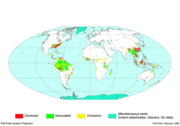
Disappearing forests UN map as of 1994.jpg 622 × 348; 74 KB
-
Dniper Reservoir.png 578 × 389; 32 KB
-
Dniprodzerzhynsk Reservoir.png 390 × 227; 16 KB
-
Dnipropetrovsk oblast detai.png 548 × 344; 44 KB
-
DOD Selected Failed States (UN Estimate, 1996).png 704 × 479; 43 KB
-
Donetsk oblast detail map.png 249 × 309; 16 KB
-
Durisol.png 500 × 350; 29 KB
-
E1 plan area.jpg 622 × 475; 96 KB
-
E1-Maale Adumim-annexation-plan-2005.png 14,033 × 9,920; 3.25 MB
-
Eastern Croatia map.png 1,880 × 2,353; 1.14 MB
-
Eastern South Asia.png 1,292 × 2,000; 580 KB
-
Ein Gev - Al Samra - Al Hamma Demilitarized Zone.png 1,337 × 2,354; 160 KB
-
En.Wikipedia-VideoWiki-Cholera.webm 3 min 11 s, 1,280 × 720; 8.93 MB
-
Epirus greece.png 297 × 253; 16 KB
-
Ermera detail map.png 201 × 160; 11 KB
-
Expanded Jerusalem 1967.jpg 868 × 1,346; 256 KB
-
Farah province detail map.png 458 × 294; 23 KB
-
Ferralsol.gif 500 × 351; 27 KB
-
Fluvisol.gif 500 × 351; 29 KB
-
Former Yugoslavia Map.png 3,280 × 2,398; 2.55 MB
-
Gabčíkovo-Nagymaros map no.1.png 798 × 497; 71 KB
-
Gabčíkovo-Nagymaros map no.2.png 798 × 501; 89 KB
-
Gabčíkovo-Nagymaros map no.3.png 800 × 492; 78 KB
-
Gamla on the map (ru).svg 1,016 × 1,285; 448 KB
-
Gaza casualties info-graphic 19 June 2024.pdf 1,239 × 1,752; 5.09 MB
-
Gaza city access and closure july 2018.png 1,683 × 2,381; 1.5 MB
-
Gaza Strip 2009 Jan 13.png 1,062 × 1,504; 369 KB
-
Gaza Strip Access Restrictions.pdf 4,950 × 7,085; 4.76 MB


